Total Distance and Length
The standard trail of the Manaslu region covers 177 kilometers (110 miles) in total distance. You have the flexibility to choose Machha Khola ahead of Soti Khola as your starting point, as most do. Why? Beginning your trek at Machha Khola with an endpoint at Dharapani lowers the overall distance to 145 kilometers, which equals 90 miles! The total distance spans 160 and 180 kilometers according to your route, rest day, and walking speed. Trekking in the Manaslu route demands 11 to 14 days with daily walks at distances between 10 to 20 kilometers per day.

Also, the distance will lengthen when you choose to explore side trips during your trek. The additional stop at Tsum Valley adds 200 kilometers to the total trekking distance. Beginning your trek from the lower point of Arughat, combined with ending beyond Dharapani, will result in increased total distance.
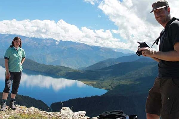
But at the end, every step becomes rewarding because you can enjoy scenic views of mountains combined with valleys and traditional village landscapes.
Types of Itineraries that Influence the Manaslu Trek Distance
Want to explore the Manaslu Region with diverse needs? Your Walking distance and duration differ based on the chosen Manaslu Trek itinerary. This trekking experience can be finished in different amounts of time due to the diverse trek lengths. Here are some popular options available:
Standard Itinerary (Manaslu Circuit Trek 16 days)
The standard Manaslu Circuit Trek attracts the most hikers among all the available routes. Spending 16 days on the trek will allow you to explore the views while your body acclimatizes itself to the high-altitude conditions. Your journey starts with two days in Kathmandu before reaching Maccha Khola to start trekking. Your body needs two rest days to adapt properly to the reduced oxygen levels at high elevations. You will ultimately traverse 177 kilometers and cross Larkya La Pass, which stands at 5106 meters.
Short Itinerary (Short Manaslu Trek 10 days)
Short on time? For people who want to experience Mount Manaslu without taking too much time, the short Manaslu trek suits all their needs. You can experience the same main route in 10 days, where you will speed up the journey and avoid rest stops on selected days. Going through this region demands more effort from your body because it must adjust to high altitudes within less time.
Manaslu Tsum Valley Trek
The Manaslu Circuit gains additional beauty by including the scenic exploration of Tsum Valley as an optional tour. The total distance of the Manaslu and Tsum valley Trek extends by 50-60 kilometers, while it requires around 20 days to complete. The old Tibetan Tsum Valley features stunning monasteries and breathtaking mountain panorama views.

Manaslu Round Trekking
The Manaslu Round trek follows the main circuit route while making optional additional stops at viewpoints or villages outside the main path. It lasts 15 days and covers 177-190 kilometers in total distance. It is the same as the standard Manaslu circuit and follows the same acclimatization days; hence, you can choose either the classic Manaslu Trek route or this. It simplifies the same, but yes! there are some price differences for sure!
Manaslu Circuit Budget Trek
Following the standard trail, the budget option maintains straightforward lodging at rustic teahouses and provides minimal dining experiences. The Budget Manaslu trek requires 14 to 16 days while traveling the same 177 kilometers of distance. The best part? This trek reduces expenses while providing the same path as standard routes.
Manaslu and Annapurna Circuit Trek
The lengthy combination of the Thorong La and Larkya La Pass Trek connects two well-known treks in Nepal into a single enormous expedition that takes 23 days to complete while traversing approximately 300-350 kilometers. After finishing the Manaslu Circuit route, you proceed to the Annapurna Circuit Trek instead of taking a vehicle back to Kathmandu from Dharapani. You get the best of both worlds!
Highest Elevation along the Trail
Larkya La Pass stands as the highest elevation along the Manaslu Circuit, which is located at 5,160 meters (16,930 feet) above sea level. The majority of trekking groups cross Larkya La Pass during their day 13 itinerary while undertaking the standard trek route during morning hours. As you stand at the summit, you will observe more than ten recognizable peaks as well as Mt Manaslu, Annapurna II, Himalchuli, Ngadi Chuli, and Cheo Himal.
Long Duration and Trekking Hours
You will need to walk 5-7 hours throughout each day during this trek. You will spend 4-5 hours walking on shorter days but the most strenuous day will require 8-9 hours to cross Larkya La Pass. But don't worry! At elevated areas with thin air, your guide will maintain a controlled walking speed. Walking hours include a brief snack, photo stops, and a longer lunch break.
Highlights of The Manaslu Trek And Key Stops
Samagaun (3,530m)
Samagaun is a traditional Tibetan Buddhist village and your first acclimatization stop while hiking the Manaslu Circuit. The village of Samagaun extends across a wide valley beneath Mount Manaslu as it maintains a Tibetan heritage, where each stone house includes flat roofing. The village possesses one of the most beautiful old monasteries, named Pungyen Gompa, adorned with colorful prayer flags. Your acclimatization day at this location offers you time to adjust your body to the elevated altitude while standing as one of the most genuine mountain settlements along the trekking route.
Birendra Lake
You can find the charming blue glacial lake Birendra Lake at 3,700 meters, next to Samagaun village. The walking journey from Samagaun to this destination requires 2 to 3 hours, which makes it an ideal spot for people who want to acclimatize. You can see Mount Manaslu perfectly from the calm, blue-green lake surface.

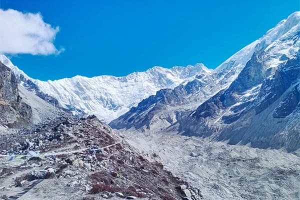
Manaslu Base Camp
The next acclimatization stop is Manaslu Base Camp which reaches 4,400 meters elevation which requiring between 4-5 hours of trek from Samagaun. The base camp features colorful tents belonging to climbing teams when they operate in the climbing season. The highlight? You obtain stunning perspectives of both Manaslu Glacier and the southern face of Manaslu.
Samdo (3,875m)
Samdo exists as the final permanent settlement before the Larkya La Pass which is located just 15km away from the Tibet border. With around 40 houses and monastery and a school, Samdo operates as a permanent settlement at this high-altitude pass. People use Samdo as their final base before attempting the challenging high pass.
Tibetan Border (Rui La Pass)
The trek from Samdo village leads to Rui La Pass (4,700 meters)where you can visit the Tibet border within one day (4-5 hours). The historical trading route guides you through stunning mountain scenery and rocky terrains. The detour trip allows your body to adjust properly while exposing you to meaningful Tibetan cultural aspects during your trek to Manaslu.
Optional Side Trips and Extension
Want to make your Manaslu Trip more rewarding? Check out the following side trips and extension options for a more meaningful journey:
Ganesh Himal Base Camp (4-5 days)
A northwest extension originating at Khorlabesi leads you through untouched forested landscapes and Gurung ethnic villages until the base of magnificent Ganesh Himal. Along this less popular route, you will have a peaceful time in alpine meadows while enjoying grand views of peaks inspired by Hindu mythology.
Monastery Circuit (2-3 days)
A religious trekking path runs through numerous secluded Buddhist places of worship that you cannot access by typical paths. Climb up from Sama Gaun to reach Mu Gompa at 3,700m then continue walking to Gumba Lungdang to witness Tibetan monks conducting their morning prayers in a serene environment.
Gorkha Durbar Trek (3-4 days)
Experience historical Nepal by wandering through sites that created the unified nation. Before starting your mountain adventure, you will explore terraced cultivation fields which lead to Gorkha Palace to learn about the local culture.
Manaslu Conservation Area Wildlife Tour (2 days)
Are you a nature lover? This guided pre-trek tour organizes wildlife observation through the Manaslu Conservation Area. The diverse ecological zones maintain a habitat for red pandas along with Himalayan tahr and more than 110 different bird species.
Ruby Valley Route (5-6 days)
A less popular route links the Manaslu region to Langtang while sharing the unspoiled landscapes of Ruby Valley which includes natural hot springs with unvisited villages.
Alternate Treks for Newbies
The Manaslu Circuit is a trek that can be done by newbies but the majority opt for simpler routes. Most newbies may find the remoteness and limited accessibility of the Manaslu region intense for the first time. The restricted area needs a guide compulsorily and the trails are rugged and hard to navigate. If you are looking for something less demanding that is not inside a restricted as well as easily accessible with proper facilities along the route, there are many options to choose from. Beginners can try out simpler treks that best fit their level.
The Poon Hill Trek stands as an optimal choice for anyone starting their trekking journey. The total duration for this trek is 4-5 days with about 4-5 hours of daily walking that reaches up to an elevation of 3,210 meters. You can admire spectacular sunrises while looking at numerous big mountains from Poon Hill.
The Mardi Himal Trek combines easy level difficulty with a suitable challenge for those new to trekking. This 5-7 day trek requires daily walking distances of 5-6 hour,s which leads you near the Annapurna mountain range without excessive heights. The highest point reaches 4,500 meters at Mardi Himal Base Camp for stunning views of the surrounding mountains.
The Langtang Valley Trek is perfect for first-timers who want to revel in cultural immersion, while reveling in the amazing views of the mountains and conveniently reachable from the capital, Kathmandu. This 7-8 day trip requires 5-6 hours per day of walking and you can reach up to 3870 meters to Kyanjin Gompa and you can climb Kyanjin Ri. The trek provides a chance of getting to see Tamang heritage, Buddhist monasteries as well as yak pastures while enjoying the sight of Langtang Lirung and other peaks.
The Khopra Ridge Trek provides an excellent alternative to more crowded trails that takes 7-9 days with 5-6 hours of trekking a day which is not difficult for a beginner. Rising to its highest level at 3660 meters, the trail offers stunning panoramas of the Annapurna & Dhaulagiri Ranges, taking you through traditional villages and lush rhododendron jungle.
Suggested Tips for Planning a Successful trek
- You need a Restricted Area Permit combined with Manaslu Conservation Area Permit and Annapurna Conservation Area Permit to trek in Manaslu region of Nepal.
- A guide is mandatory for the Manaslu region according to Nepali legal requirements. A quality guide possesses complete knowledge of the region's geographical characteristics as well as local customs and proper safety procedures for high-altitude environments.
- The most favorable periods for Trekking Manaslu Circuit span from spring months of March to May and fall months of September through November. Larkya La Pass becomes extremely hazardous in winter due to heavy snow while summer conditions include monsoon rains, leeches and trail blockages.
- The Manaslu Circuit is challenging! You need to exercise with cardio equipment together with stair climbing and long-distance backpacking sessions, for at least 2-3 months leading up to your trek.
- Your high-altitude hike requires good hiking boots together with warm layers and quality sleeping bag equipment but remember, additional weight makes you feel heavier at these altitudes.
- Never rush at high altitude. Climb high during daylight and sleep at lower altitudes while implementing rest days according to plan. You should consume about 3-4 liters of water each day while avoiding alcoholic beverages.
- You need to bring sufficient cash since there is no ATM service available during the trek. You need to bring Nepali rupees to cover costs like food, accommodation, and additional porters in addition to emergency funds.
- Get insurance coverage that includes helicopter evacuations extending to heights of 6,000 meters because typical travel insurance plans do not provide this option for high-altitude activities.
Conclusion: Final Say
Whether short or long, no matter the length of your Manaslu Trip, this trek offers thrilling opportunities for people seeking adventure to witness Nepal's stunning mountain panorama. Trekking 177 kilometers across 14-16 days permits explorers to experience this perfect blend of exploration and scenery. Wandering from green valleys to the magnificent Larkya La Pass summit at 5,160 meters will allow you to admire stunning scenery while encountering different ethnic groups.
Check out our diverse and customizable Manaslu Trek Packages that fit all your needs. Contact Us anytime.